Topography
Advertisement

Ra2dTomo v.0.8
Ra2dTomo is a tool for 2d refraction tomography. It is able to incorporate arbitrary surface topography by the use of unstructured triangle meshs.
Advertisement
RCAD v.2.8
RCAD is a graphic core distributed together with different applications (like RTOPO or VDAFS to DXF&NC). Is useful in topography for "Digital Terrain Modeling" (DTM) by "Triangulated Irregular Network" (TIN), representation (by 3DPOLY,
Matlab SRTM Library v.1.0
The Matlab SRTM Library is designed to be an easy-to-use interface for importing and manipulating NASA's Shuttle Radar Topography Mission (SRTM) Digital Elevation Model (DEM) dataset.
AutoLisp Source v.1.1
6 AutoLISP source code can be run on AutoCAD or IntelliCAD, on any number of computers for: Triangulation, Load XYZ and 4D files, B-spline control polygon and interpolated contour lines, Intersect 2 3DFACE and Modify longitudinal profile, DWG to XYZ.
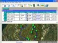
EdiTrail v.1.0
Create/Edit/Display/Management/Import/Export Trails/Routes in a simple and flexible environment divided in a data table for the management of trails and a map resulting from numerous providers, (Bing, Arcgis, Ovi, Yahoo, etc).
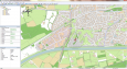
Eye4Software GPS Mapping Studio v.4.1
GPS Mapping Software for Windows, Loading topographic maps, Realtime navigation, GPS position tracking, Map import and export, Coordinate conversion and more
FreeView v.10 3
Geomatica FreeView is a flexible data viewing tool supporting over 100 raster and vector formats for loading, viewing, selection, and enhancement. FreeView is useful for any geospatial data viewing application, and is freely distributable.
Operation Peacekeeper v.0.32
During a meeting of German and Serbian armed forces a Serbian Officer is shot down by an unknown sniper. Caused by some misunderstandings a gunfight between Serbian and German soldiers starts which causes casualties on both sides.
Geomatica FreeView v.9. 1. 2005
Geomatica FreeView is a flexible data viewing tool supporting over 100 raster and vector formats for loading, viewing, selection, and enhancement. FreeView is useful for any geospatial data viewing application, and is freely distributable.
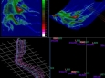
Potent v.4. 11. 2006
Potent is a Windows application that provides a highly interactive framework for 3-D modelling of magnetic and gravity data. This example uses one of Geosoft's Oasis montaj sample datasets.
FlashMNT v.3 1
FlashMNT is a program that allows the creation of a Digital Terrain Model and 3D computations, comprising the following functions: data verification, triangulation, 3D area computation, cut/fill quantities between 2 DTM's, cross section, meshing, ent